Cirencester (Corinium Dobunnorum) Roman Fort
Neronian Auxiliary Fort (AD 54–68), Vexillation Fort and Vicus
The sole evidence for the presence of a Roman campaign or Claudian “vexillation” fortress at Cirencester are two parallel ditches, dug close together with hardly any intermediate berm, the entire system being almost W-shaped in profile, the distance between the two outer ditch lips is only about 10 feet (c.3 m). These ditches ran roughly north-east to south-west and were sealed beneath the intervallum road of the later auxiliary fort – built upon the same alignment – which confirmed their earlier construction date. Various sherds of pottery recovered form the ditch-fill included pre-Claudian and early-Claudian forms, also some fragments attributed to the late-Iron-Age. “A date in the 40’s would not seem unreasonable for this initial phase of activity” (McWhirr).
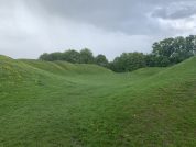
The Neronian? Auxiliary Fort – The entire north-western side of this fort, including its northern and western corner-angles, has been recorded by excavation, measuring about 540 feet (c.165 m) long. The arrangement of the recorded internal buildings suggest that the transverse measurement would have been in the region of about 360 feet (c.110 m), which would give an internal occupation area of around 4½ acres (c.1.8 ha). The defences consisted of a turf rampart fronted by two ditches; the rampart measured 20 feet (c.6 m) wide at its base, and survived to a height of only 8 inches (c.20 cm), the inner ditch measured 8¼ feet wide by almost 4 feet deep (c.2.5 x 1.2 m), the outer ditch, inferred by subsidence of the later civil buildings, is thought to have possessed the same profile as the inner, the distance between ditch centres being about 55 feet (17 m).
The space between these ditches was seemingly strewn with obstacles such as sharpened stakes (cippi) or whole branches (cervi) to impede any would-be attacker, their presence revealed by a number of irregularly-spaced post-holes. There is evidence also for the presence of a third, intermediate ditch to either side of the road leading to the camp’s north-western gateway, Ermine Street, which formed the via principalis of the fort. The ditches of the earlier fortress run just inside the fort’s north-western rampart, parallel with it and sealed beneath the road behind the fort rampart, the via sagularis; both camps were therefore built upon the same alignment, and there is evidence to suggest that the fort faced towards the north-east.
Classical References to the Roman Fort at Cirencester (Corinium Dobunnorum)
Corinium Dobunnorum – Cironion of the Dobunni
“… Next to these [the Silures] are the Dobuni, and their town Corinium 18*00 54°10 …”
Cirencester started off as small vicus settlement, first outside, then within the defences of the Roman fort which was built here in the early first-century. By the second century the town had expanded to become the largest in the province, in terms of population, with perhaps 12,000 inhabitants. The town was likely among those visited by the emperor Hadrian during his trip to Britain in the early second century, and the tribal council marked his visit by building a macellum or covered market in the centre of their principal city. In the third century Corinium was surpassed in size only by Londinium, and covered in its heyday an area of 240 acres, its civic buildings and town houses being of an almost uniformly high standard, and also possessed of an impressive amphitheatre built outside the town defences.
A Discrepancy in Antonine Iter XIII
The second century document the Antonine Itinerary contains many of the major road routes in the Roman empire, and includes fifteen from the province of Britannia. The Thirteenth Itinerary is entitled “The Route from Isca to Calleva,” and lists the Roman stations along the road between the fortress of the Second Augustan Legion at Isca Silurum (Caerleon, Gwent), and the ancient capital of the Atrebates tribe, Calleva Atrebatum. This route evidently passed directly through Cirencester, but, although normally quite reliable, the Itinerary is unfortunately defective in this area.
- The original sources give the distance in the title line of the itinerary as “one hundred and nine thousand paces” or 109 Roman miles.
- The accumulated total of the mileage listed between each of the road stations is 19 miles short of the total stated at the top of the itinerary.
In most cases the distances recorded in the Antonine Itinerary are reasonably accurate, although there are obvious errors in the Thirteenth Itinerary following the entry for Gloucester. In the first instance, an unknown copyist has missed out the entry for Cirencester, which lies 17 Roman miles from Gloucester and 15 from Wanborough; the missing line should read Corinio xvii. Secondly, there is clearly another discrepancy in the latter half of Iter XIII where the total distance reported between Durocornovio and Calleva is thirty miles, whereas the actual measured distance is closer to thirty-two. It would appear, then, that the other two ‘missing’ miles should most likely be allocated somewhere in the lower portion of the itinerary. Unfortunately, the exact location of the Spinis station is unknown as yet, so until someone unearths it Iter XIII will remain unclear.
The Meaning of the Ancient Name
Cirencester Korinion c.150, Cirenceaster c.900, Cirecestre 1086 ( DB ). ‘Roman camp or town called Corinion‘. OE ceaster added to the reduced form of a name (Welsh/Gaelic) of uncertain origin and meaning.” (Mills, 1998)
It should be noted that Cirencester is also listed in the Ravenna Cosmology (R&C#66) as Cironium Dobunorum, appearing between the entries for Salinae (Droitwich Spa, Hereford & Worcester) and Lactodurum (Towcester, Northamptonshire). The name Corinium is a Romanisation of the town’s original name (Welsh/Gaelic), perhaps Cironion, the original meaning of which remains unknown.
Aside from Iter XIII and the Fosse Way – another Curious omission from the Antonine Itinerary – another road left Corinium northwards, which, although its terminus is unknown, passed within two miles of the known minor settlement and temple at Wycombe, eleven miles to the north. Possible termini of this road are Alcester in the north, or more likely, Droitwich or Vertis (Worcester, Hereford & Worcester) in the north-west. Also of interest is a Roman milestone, found on the Fosse Way at Turkdean, 11 miles north-east of Cirencester (RIB 2315.c; dated: 296-337?), which reads simply FIL.
References for Corinivm Dobunnorum
- Oxford Dictionary of English Place-Names by A.D. Mills (Oxford 1998);
- The Towns of Roman Britain by John Wacher (2nd Ed., BCA, London, 1995) pp.302-323 & fig.136;
- Cirencester (Corinium Dobunnorum) by Alan McWhirr in Fortress into City (Batsford, London, 1988) chap.4 pp.74-90;
- The Roman Inscriptions of Britain by R.G. Collingwood and R.P. Wright (Oxford 1965).
Map References for Corinium Dobvnnorum
NGRef: SP0201 OSMap: LR163
Roman Roads near Corinium Dobvnnorum
ENE (18) to Asthall (Oxfordshire) Fosse Way: NE (15) to Bovrton (Gloucestershire) NE (6) to Chedworth Iter XIII: NNW (7) to Colesbovrne NW (17) to Glevvm (Gloucester, Gloucestershire) Fosse Way: SW (13) to White Walls (Easton Grey, Wiltshire) SE (7) to Cricklade (Wiltshire) NW (2.75) to Daglingworth Probable Road: N (16) to Spoonley Wood Probable Road: N (16) to Wadfield
Sites near Cirencester (Corinium Dobunnorum) Roman Fort
- Corinium Dobunnorum (Cirencester) Vicus (0 km)
Vicus - Corinium Dobunnorum (Cirencester) Amphitheatre (1 km)
Amphitheatre - Fosse Way (1 km)
Roman Road - Ermin Way (2 km)
Roman Road - Daglingworth Villa (4 km)
Villa - Bagendon Settlement (5 km)
Iron Age Settlement and Settlement - Barnsley Park Villa (7 km)
Villa - Combend Villa (11 km)
Villa - Cricklade Roman Settlement (11 km)
Minor Settlement - Chedworth Roman Villa (12 km)
Villa


