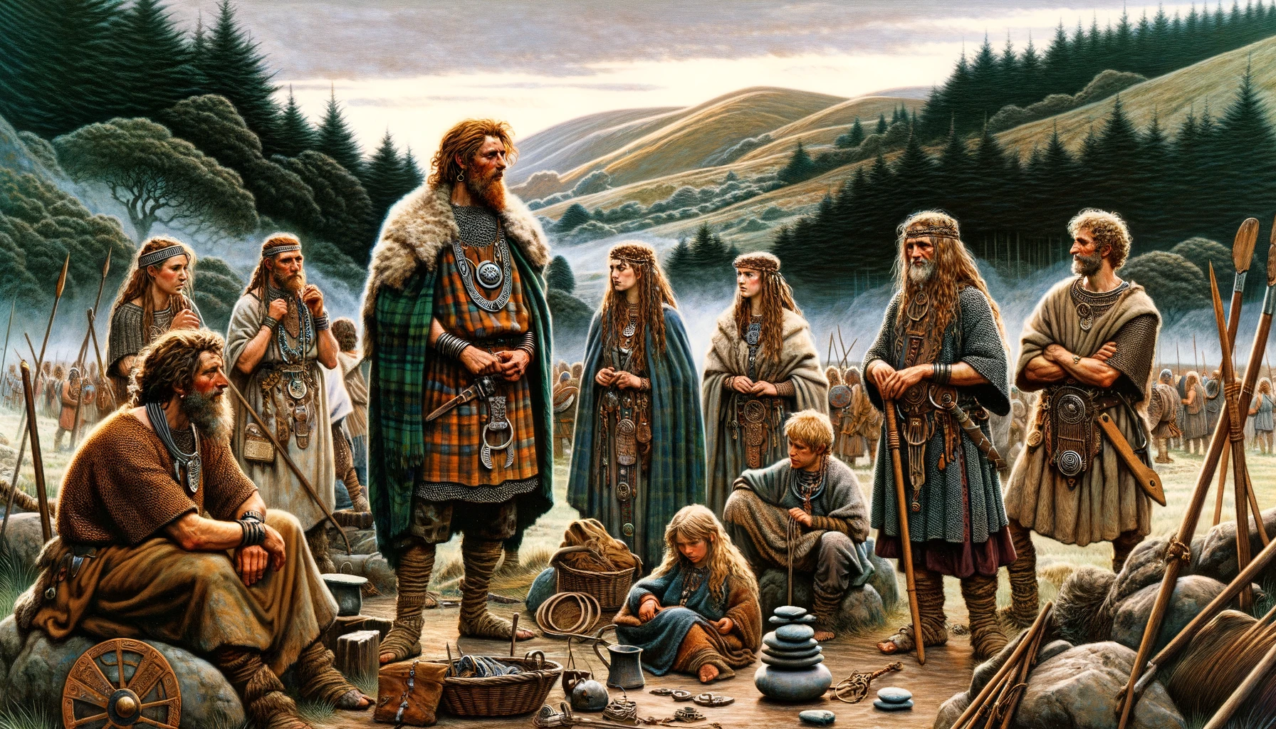
The Ordovices tribe inhabited mainly south Gwynedd and south Clwyd, apparently including parts of western Shropshire and Hereford & Worcester. Like most Welsh tribes they had no self-governing institutions, no Romanized capital and were probably under military government. Their lands are littered with strongly defended hillforts.
The Realm of the Ordovices according to Ptolemy
“… some distance toward the west are the Ordovices, among whom are the towns: Mediolanum 16*45 56°40 Brannogenium 16*45 56°15.”
The Geography of Ptolemy
They were bordered to the north-east by the Deceangi, to the east by the Cornovii, on the south-east by the Silures and to the south-west by the Demetae.
Other passages in Ptolemy Book II Chapter 2 give the ancient names of a few geographical features within the territories of the Ordovices tribe:
- Stuctia Fluvius (Afon Ystwyth) Possibly marking the border with their south-western neighbours, the Demetae.
- Tisobis Fluvius possibly the Afon Glaslyn, more likely the Afon Dwyryd, both of which empty into Tremadog Bay near Criccieth.
- Ganganorum Promonturium (Lleyn Peninsula) The home of the Gangani sub-sect of the tribe (see below).
The Civitas Ordovicum The Principal Tribal Centre
It would appear that the tribe did not have any sort of centralized government and no tribal council. It is assumed that they were placed under direct military rule by the Roman administration in the province.
The Tribal πολεις (Poleis or Settlements) Assigned by Ptolemy
- Whitchurch (Mediolanum): An apparent mistake by Ptolemy, as Whitchurch is thought to have been sited within the territories of the Cornovii.
- Leintwardine (Bravinium): A complex of forts and marching camps in the Welsh Marches. It is possible that the tribe was administrated from here.
Other Roman-British Sites
- Mona (Anglesey Island, Gwynedd) – Probable Druidical Centre.
- Segontivm (Caernarfon, Gwynedd) – Minor settlement and fort.
- Maglona (Pennal, Gwynedd) – Probable southern border settlement and fort.
- Caer Gai (Gwynedd) – Minor settlement and fort.
- Brithdir (Gwynedd) – Minor Settlement.
- Caersws (Powys) – Possible southern border settlement and fort.
- Tomen y Mur (Gwynedd) – Fort.
- Llanfor (Gwynedd) – Fort.
- Llwyn y Brain (Powys) – Southern Border Fort nearby Caersws.
Industrial Sites
Industry on the mainland is represented by the sole tile-kiln found at Dolgain in Gwynedd. There are substantial Roman buildings at Tremadog, also in Gwynedd, though of unknown function.
Ordovices offer refuge to British warlord Caratacus 50AD
The second governor of the new Roman province of Britain was Ostorius Scapula, who, during his first campaign season (48AD) had crushed a neighbouring tribe, the Deceangi of north-east Wales, and was preparing to assault Anglesey when he was recalled by an outbreak of dissention amongst the Brigantes in the north of England. The preparations against Anglesey would have taken place in the northern territories of the Ordovices, perhaps of a sub-tribe going by the name Segonti / Segontiaci.
The attentions of Scapula were the following season [49AD] drawn towards the lands of the Silures tribe in south-east Wales, where the British warlord Caratacus had moved his campaign camp. Ostorius moved the Twentieth Legion from Camulodunum (Colchester) on the eastern coast, to a new base at Glevum (Gloucester), near the mouth of the River Severn.
“… on this occasion, favoured by the treacherous character of the country, though inferior in military strength, he [Caratacus] astutely shifted the seat of war to the territory of the Ordovices: where, after being joined by all who feared a Roman peace, he put the final chance to trial. …” (Tacitus Annales xii.33)
Ostorius moved Legio XIV Gemina from its base at Manduessedum (Mancetter, Leicestershire) to a new legionary fortress at Viroconium (Wroxeter, Shropshire), close to the mid-Wales border. This legion marched west and was joined by the Twentieth marching-up from the south, and, somewhere in mid Wales – the site has yet to be identified – The forces of Caratacus were soundly defeated. This story is narrated in Tacitus’ Annales XII.33-37.
It is very likely that a substantial part of the Ordovician fighting force was either destroyed or captured when the army of Caratacus was defeated, for nothing else is heard of the tribe for almost thirty years. The governor Suetonius Paulinus must have conducted operations in Ordovician territory around 60/61AD, however, in preparation for his proposed conquest of Mona (Anglesey); preparations which were once again abandoned, this time due to a revolt in the south-east of Britain, fomented by the abused Queen Boudicca of the Iceni.
Ordovices Decimated by Governor Julius Agricola AD 78
The tribe seem to have recovered their fighting strength by the last quarter of the first century, however, for we are told:
“… The tribes of the Ordovices, shortly before his arrival [winter 77-78AD], had crushed almost to a man a regiment of cavalry encamped among them; and this first stroke had excited the province. Those who wanted war applauded the precedent, and waited to see how the new governor would react.” (Tacitus Agricola xviii.1)
Tacitus here uses the words Ordovicum civitas which translates as ‘the state of the Ordovices’, though it is improbable that any such ‘state’ ever existed, particularly since there seems to have been no centre of government in the region throughout the entire Roman occupation of Britain.
“… He [Agricola] gathered the detachments of the several legions and a small force of auxiliaries, and then, when the Ordovices did not venture to descend from the hills, led his army to the uplands, himself marching in the van …” (Tacitus Agricola xviii.2)
Agricolan forts and encampments from this campaign probably include Pen-y-Gwrhyd and Bryn-y-Gefeiliau in the heart of modern Snowdonia. The fate of the Ordovices is without doubt, recorded in the words of Cornelius Tacitus.
“He almost exterminated the whole tribe: …” (Tacitus Agricola xviii.3)
The Ordovices tribe were never to recover significantly in the aftermath of Agricola’s campaigns, for their lands have yielded hardly any archaeological evidence of civilian occupation which can be dated specifically to the Romano-British era.
General Notes
The Ordovices had no self-governing institutions and no Romanized capital. The territories of the tribe were probably under military government from the time they first came under the rule of Rome during the early governorship of Agricola.
The geographical distribution of the tribe was mainly south Gwynedd and partly south Clwyd.
Most of the tribe lived either in the hillforts which are prevalent in the area, or else in the immediate environs, probably within sight of these fortified towns, to which they would retire when threatened.
Several hillforts can be attributed to the eastern half of the Ordovician territory; Castell Dinas Bran, Moel y Gaer (Llantisilio), Caer Drwyn and Caer Euni, all in the Deva valley within easy striking distance of the lowland territories of the Cornovii in the region of Old Oswestry.
On the other (southern) side of the Berwyn range from these settlements, there is a hillfort at Craig Rhiwarth deep in the Tanat valley at the extreme northern tip of Powys. This fort marks the boundary between the Ordovices and their more refined neighbours the Cornovii.
The neolithic chambered long cairn at Capel Garmon near Betws-y-Coed can possibly be attributed to the Ordovices, as it lies within the tribal territories.
The western part of their tribal territory included Dinas Emrys at the foot of Mt. Snowdon, Moel Goedog overlooking the mouth of the Tisobis Fluvius near Harlech, and a number of fortresses along the length of the Ganganorum Prom. (Lleyn Penninsula), from Dinas Dinlle on the north coast, overlooking the southern Menai and Mona Insula, to Castell Odo on the south-western tip.
Ptolemy provides us with the names of two rivers in Ordovician territory; the Tisobis and the Stuctia.
It is of note that among modern geologists, the second period of the Palaeozoic era is known as the Ordovician, because rocks belonging to this period form outcrops in the Snowdownia region, within the territories of the Ordovices tribe. This geological time-period occurred between the Cambrian and the Silurian,¹ and lasted 60 million years, during which the marine invertebrates flourished.
- Named after the neighbouring Silures tribe of south-east Wales, where outcrops of Silurian rocks occur.
Notes Compiled from Salway
Caratacus took refuge in the land of the Ordovices in c.50AD where he organised the resistance against Ostorius Scapula.
Frontinus established several garrison forts in Ordovician territory following his successful campaign against the Silures of South Wales; those in the upper Severn valley marking the line of penetration from Viroconium into North Wales are an example of his work.
Immediately before the governorship of Agricola, the Ordovices almost annihilated a regiment of Roman cavalry stationed in their territory. This may have taken place in the governorship of Frontinus, but there may have been a gap before the arrival of Agricola during which period, the destruction of the Ala took place.
Shortly after his arrival in Britain, Agricola took the Twentieth Legion into north Wales, massacred the Ordovices and conquered the stronghold of the druids on Mona in a single campaign in the late summer of 78AD. Agricola was legatus legionis XX under Cerialis, and he used this legion for this, his first campaign as provincial governor, probably because he knew the men and wanted every factor in his advantage.
The outcome of Agricola’s campaign in 78AD was the near annihilation of the Ordovices, and the settlements did not recover until the third century.
The Minor Tribes
The Gangani
The Gangani tribe of the Lleyn Penninsula were probably kept in check by the garrison of the fort at Pen Llystyn. This fort possibly marks the border between the Gangani and the Ordovices. The name of the tribe is contained in the Roman name for the Lleyn Peninsula, Ganganorum Promontorium, recorded in Ptolemy, which means ‘The headland of the Gangani’.
The Segonti or Segontiaci
This tribe is now discussed on a separate page: Segontiaci.
References for The Ordovices
- The Geography of Claudius Ptolemaeus, trans. by E.L. Stevenson (Dover, New York, 1991);
- Atlas of Great Britain by the Ordnance Survey (Country Life, 1982);
- Historical Map and Guide: Roman Britain by the OS (4th Ed., 1990);